
DRONE AERIAL MAPPING AS A VIABLE OPTION FOR POST DISASTER COMMUNITY DEVELOPMENT
Drones can cover more distance from the air compared to volunteers in vehicles or on foot. In a disaster zone, drones are vital assets in search and rescue, damage assessment, and recovery operations planning. In the next chapter for HAND, drones will be a crucial platform for rebuilding a post-disaster community.
Equipped with high resolution cameras and mapping software, these drones can fly automatically and take high quality photos and videos. These photos are then stitched together at a click of a button to form highly accurate three-dimensional maps that can be measured and annotated.
With these maps, HAND can assess the situation meticulously to plan access routes and mark important areas for re-construction, medical services, supply storage, etc.
Drones can cover more distance from the air compared to volunteers in vehicles or on foot. In a disaster zone, drones are vital assets in search and rescue, damage assessment, and recovery operations planning. In the next chapter for HAND, drones will be a crucial platform for rebuilding a post-disaster community.
Adrone can fly to a disaster zone that is cut off from access. It can avoid risky and dangerous situations on the ground by observing from a safe distance in the air. At all times, video information is relayed in real-time to planners to make informed decisions.

It is estimated that drone aerial mapping can reduce three day’s work by a RAT team into one day, while eliminating risks. So, whenever post-disaster survivors hear a drone above them, they will feel comforted that help will come quickly.
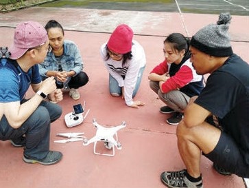
Drone deployment training in Bromo 2019 with Keng Mun and Desmond from Temasek Polytechnic Singapore.

